INRIX Smart Delivery Suite Offers Curb Insights
Mike Cottle shares vision behind new product
INRIX has long garnered headlines for its annual Global Traffic Scorecard, racking up attention (and occasional urbanist grumblings) for its rankings of congestion in various megaregions. So when the 20 year old firm announced the Smart Delivery Suite a few months back, it marked an interesting inflection point, as the company moves from people movement, to goods movement. I caught up with Mike Cottle, SVP of Enterprise and Automotive Sales, to learn more about the new tool.
Jonah Bliss: Let’s start with the basics, what’s the INRIX Smart Delivery Suite?
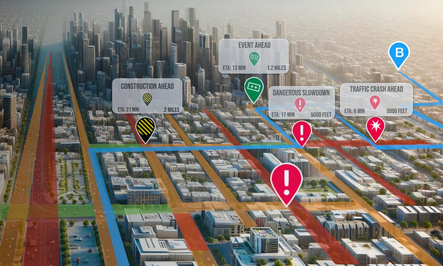
Mike Cottle: The INRIX Smart Delivery Suite is a set of cloud-based applications designed to help businesses effortlessly outsmart traffic, optimize delivery schedules, and provide spot-on ETAs. Whether you’re a rideshare company or last-mile delivery service, the INRIX Smart Delivery Suite provides a comprehensive set of tools to ensure deliveries aren’t just on time, but also optimized, safe, and reliable from start to finish.
JB: How does it differ from, or perhaps expand on, some of INRIX’s earlier offerings?
MC: INRIX has always been about providing drivers and software platforms with relevant information about what’s on the road. We pioneered the use of connected car data to inform drivers and navigation systems about traffic and incidents. While we have historically offered each dataset of the Smart Delivery Suite separately (i.e. parking, incidents, real-time traffic) to solve specific, siloed use-cases, we saw that many of our customers could benefit from the whole suite of products that we offered. The Smart Delivery Suite is more than just a set of APIs; it’s a comprehensive suite of solutions built to reshape how deliveries are managed for businesses where every second counts.
JB: INRIX has been known for mobility and people movement related data solutions, why push into goods movement?
MC: Our focus has been on the movement of ALL vehicles – both passenger and commercial – although delivery services are somewhat new to INRIX. For example, traffic congestion and insufficient stopping distance are major causes of large truck crashes. Integration of INRIX Dangerous Slowdowns and Incident data into Drivewyze’s road safety notification system enables accurate, proactive alerts to be pushed to drivers who are at risk of encountering a slowdown or queue.
JB: What would you say the Smart Delivery Suite does uniquely, that isn’t otherwise being offered on the market?
MC: While all of the products in the Smart Delivery Suite have their respective competition, for developers building highly scalable logistics and routing solutions based on OSM or custom routing algorithms, INRIX offers the only map-agnostic set of Traffic products to help calculate accurate real-time or future ETAs.
JB: Can you give us some examples of customers, and how they make use of the tools?
MC: Unfortunately, we are unable to name specific customers, but we work with some of the largest e-commerce and food delivery companies in the world. They use INRIX data and tools to optimize route planning for faster delivery times and select drivers based on fastest time-to-delivery-destination estimates.
JB: Have you seen the Suite’s data lead to any unexpected findings?
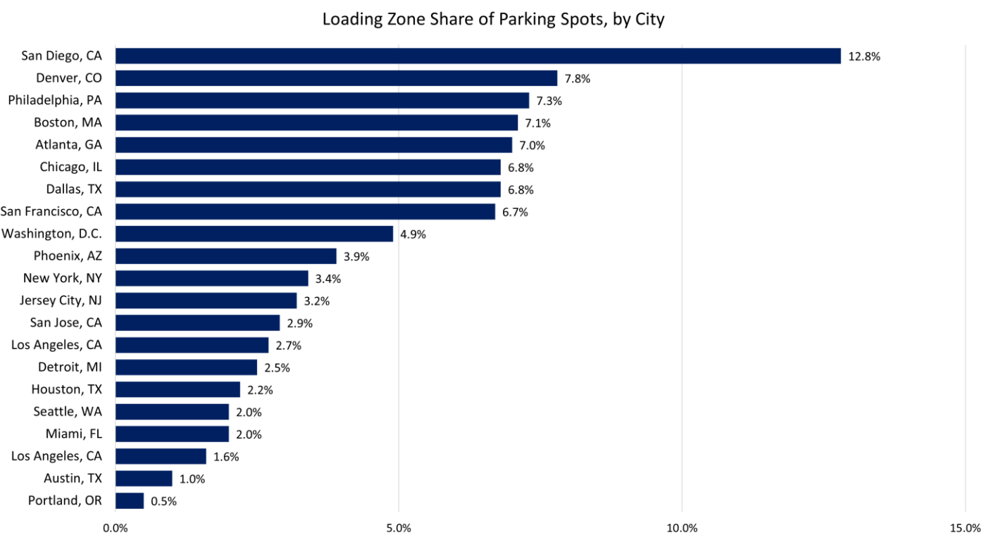
MC: In congruence with the release of the Suite, we analyzed the dwindling amount of curb space in 20 US cities, as delivery efficiency directly correlates with available curb space. Curb space depends on many things – parking, outdoor restaurant seating, bike lanes, etc.
Our research discovered that despite the country’s exponential increase in ordering goods for delivery over the pandemic (40% of NYC deliveries were residential pre-2020, 80% of NYC deliveries were residential post-2020), that doesn’t mean that the amount of curb space for said deliveries was also increasing. Products like our Smart Delivery Suite are crucial to ensuring that we can utilize the finite amount of curb space in urban areas to meet growing delivery demands.
JB: Dream big… if you could get the bulk of the industry onto this platform, how would that improve delivery, and cities overall?
MC: In a day and age where more and more people are ordering goods for delivery, a family’s pizza order within a small-town radius can be just as complex as a large shipment of freight heading across the country. If more logistics and mobility companies integrated the products in the Smart Delivery Suite, we believe we could achieve some amazing improvements to efficiency and quality of life:
Improve ETAs so that deliveries are received at the optimal time
Lower congestion by reducing double parking
Reduce carbon emissions by preventing delivery vehicles from circling the block
Make deliveries safer through our safety alerts and historical speed and volumes products
JB: And last but not least, let’s end this on a human-interest level. What drew you, personally, to the mobility and delivery tech space?
MC: With many things in one’s career, you end up getting a bunch of “Green Lights” as Matthew McConaughey says, and often you land at a place where you didn’t think you’d be after 20 years. Ultimately, I believe I gravitated to mobility and logistics because I’m a “map nerd.” Maps and geospatial technology are core to solving the challenges of mobility, logistics and delivery. When I was the Product Manager for deCarta’s navigation solution (which we later sold and is still in use by Uber), I used to say that a great navigation experience starts by finding where you want to go. Even as companies have tried to solve that for the past 25 years, it’s still an area that hasn’t been perfected for all use cases. So, there’s still a great opportunity to innovate and optimize mobility and logistics and that’s what excites me about this space.
HOT INDUSTRY NEWS & GOSSIP
Curb winners! Transit Tech Lab just announced the winners of its Curb Activity Challenge, where lucky firms will get to pilot their tech with transit operators in the NY/NJ region. Responding to the prompt of “How can we maximize the city’s curb space to serve the multiple and varied needs of New Yorkers?” the winning solutions are:
AIWaysion – Provides an integrated camera, edge computing board, and communication module within one unit to monitor curb parking events.
AppyWay – Utilizes LiDAR imagery and existing curb data to provide a comprehensive digitized curb inventory, enabling municipalities to fully manage curb regulations, parking permissions, and payments, and unlock net zero mobility.
Populus – Provides a digital curb management software enabling municipalities to better understand curb demand, inventory and manage curb regulations, and actively manage new curb use cases with hardware-free smart zones. Populus integrates data from parking meters, sensors, cameras, and mobile pay, along with curb regulation inventories into a robust platform to improve curbside safety and efficiency in cities.
Seyond – Provides integrated, privacy-sensitive tracking of vehicles and pedestrians using LiDAR.
This was the sixth edition of the Lab, which also featured a category for customer experience (think ticketing and bus tracking) as well as resilience (maintenance, scheduling.)
Q1 results abound: TNCs and 3PDs have been dropping their latest financial results, with things looking good for the industry overall. DoorDash orders grew 21% YoY to 620 million, while Instacart saw orders rise 9%, and Uber’s mobility gross bookings grew 26%, with its delivery gross bookings climbing 18%. On the pure mobility side, Lyft re-found its mojo, with gross bookings climbing 21% to $3.7B. And speaking of Uber and Instacart, the two formed a market shaking partnership, whereby Uber Eats’ restaurant listings will now show up in the Instacart app.
Bus to the future: GovTech checks in with LA’s Sidewalk and Transit Amenities Program, with 3,000 new high-tech bus shelters meant to hit the city streets in short order. Quoting Deputy Mayor Randall Winston at Curbivore 2024, the article reminds folks that “we can’t have reliable, comfortable transit without shade, to keep people cool and healthy, and especially for those who are dependent on buses.”
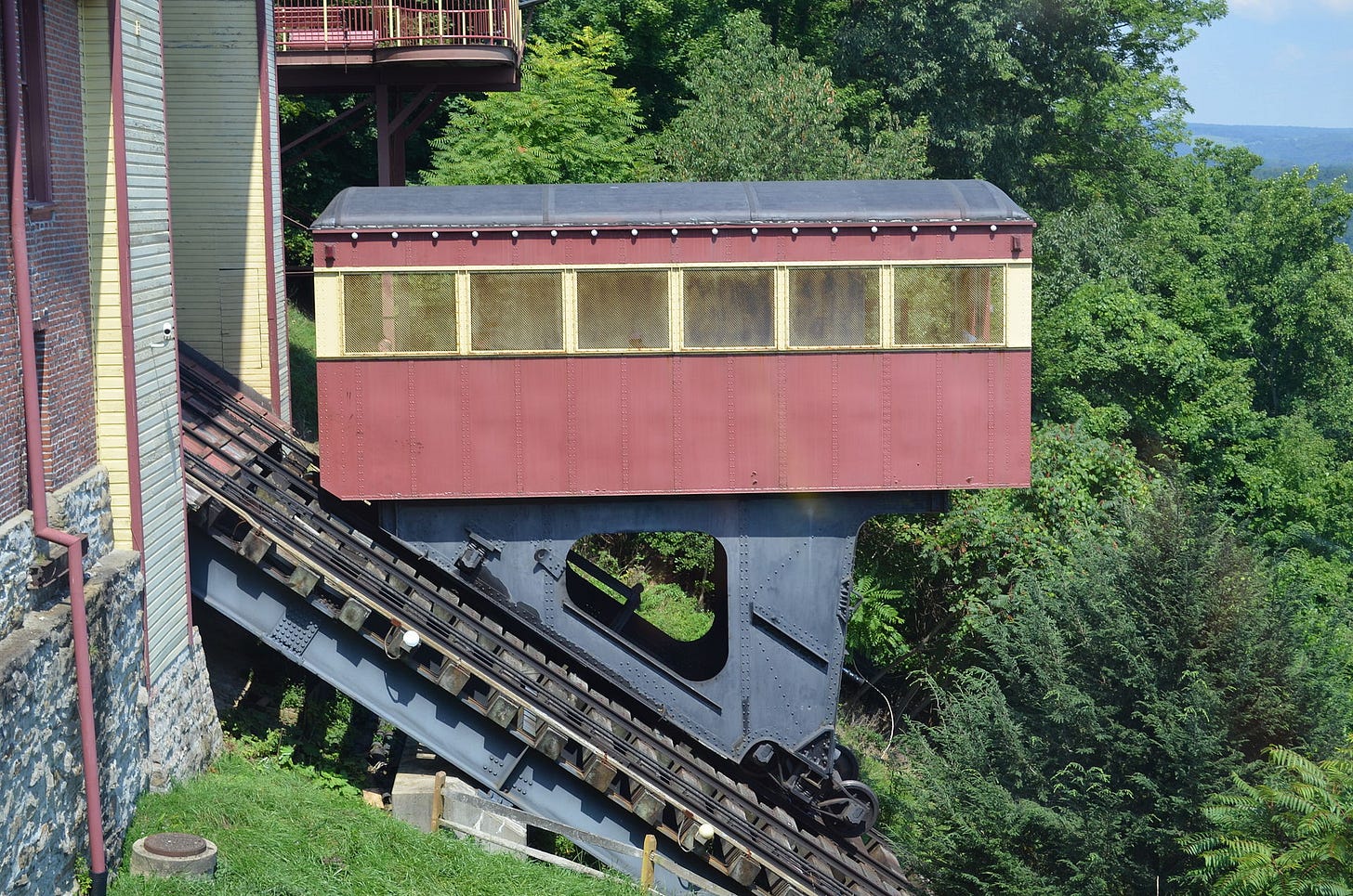
Increased pain for inclined plane: The Johnstown Inclined Plane, a unique piece of transit infrastructure in the Pittsburgh region, will remain closed for another six months while it goes through safety testing. Investigators recently found damage to its “safety cable rope,” which if left unchecked could have led to a disaster similar to the ones that have affected related machines like the Angel’s Flight funicular.
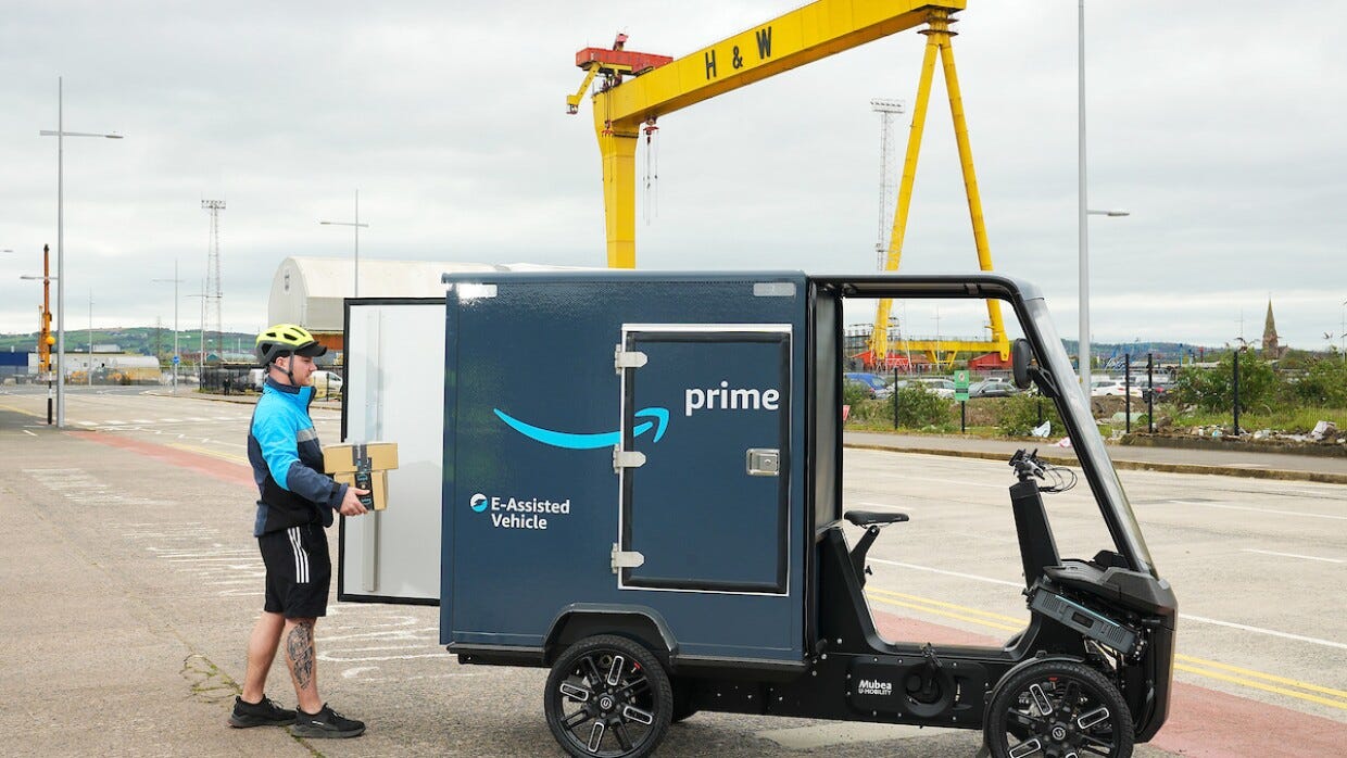
Pedal powered in Ol’ Blighty: Amazon is making a push to get more of its U.K. deliveries onto quadcyles and other micromobility devices. The company is investing £300 million for decarbonization in the UK, €1 billion across Europe, and just opened its first micromobility hubs in London, Manchester, Glasgow and Belfast. Can we get some more of that stateside?
Standardized outdoor dining: The City of New York just launched an online marketplace for street dining setups, featuring fabricators and designers, as well as standardized plans to lower restaurateurs’ costs.
A few good links: Beep launches autonomous shuttle system at Honolulu airport. Layoffs and delays hit Motional. NYC plans for more bus and bike lanes, in response to congestion cordon going live in June. Why restaurants have been slow to embrace automation. The hard life of an LA street vendor.
This newsletter will be off for the next few weeks, while we’re doing some work-related travel…
- Jonah Bliss & The Curbivore Crew


